
What Is A Drone 3d Model?
What Is a Drone 3D Model?
A drone 3D model is a digital representation of real-world objects or environments, created using aerial images captured by drones. This process, known as aerial photogrammetry, involves taking multiple overlapping photos from different angles and using specialized software to stitch them together into a precise 3D model.
Drones are widely used in aerial photogrammetry to capture high-resolution images of landscapes, buildings, construction sites, and other structures that are difficult to access. These images are then processed through 3D modeling software to generate accurate and detailed 3D models that can be used for analysis, planning, and visualization.
Why Drones Are Great for Aerial Photogrammetry
Drones offer an efficient and cost-effective alternative to traditional methods like manned aircraft or helicopters. They are easy to operate, portable, and can be deployed quickly. Many modern drones come equipped with geotagging technology, which automatically records GPS data along with each image, making it easier to align and map the captured data accurately.
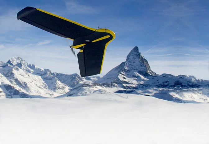 The eBee Classic, a drone made just for surveying and mapping
This geospatial data—such as altitude, longitude, and latitude—is crucial for creating accurate 3D models. With the right tools, these images can be transformed into detailed models that allow users to measure distances, calculate volumes, and analyze spatial relationships.
How To Create A Drone 3D Model
Creating a drone 3D model requires careful planning and the right equipment. Here’s a step-by-step guide to help you get started:
- Choose a high-quality drone with a good camera. For professional use, drones like the SenseFly eBee Classic are often preferred due to their precision and reliability.
- Set up ground control points (GCPs). GCPs are markers placed on the ground with known coordinates. They serve as reference points to improve the accuracy of your 3D model.
- Plan and automate your flight path. Make sure your drone is properly calibrated, with correct gimbal angles, shutter speed, and aperture settings. Also, ensure enough battery life and storage space for the mission.
- Conduct the survey on a clear day. Avoid cloudy or rainy weather to ensure the best image quality and reduce risks to your equipment.
- Use 3D modeling software to process the data. Platforms like Pix4Dmapper or Agisoft Metashape can transform your images into detailed 3D models. Depending on your needs, you might also work with a GIS specialist.
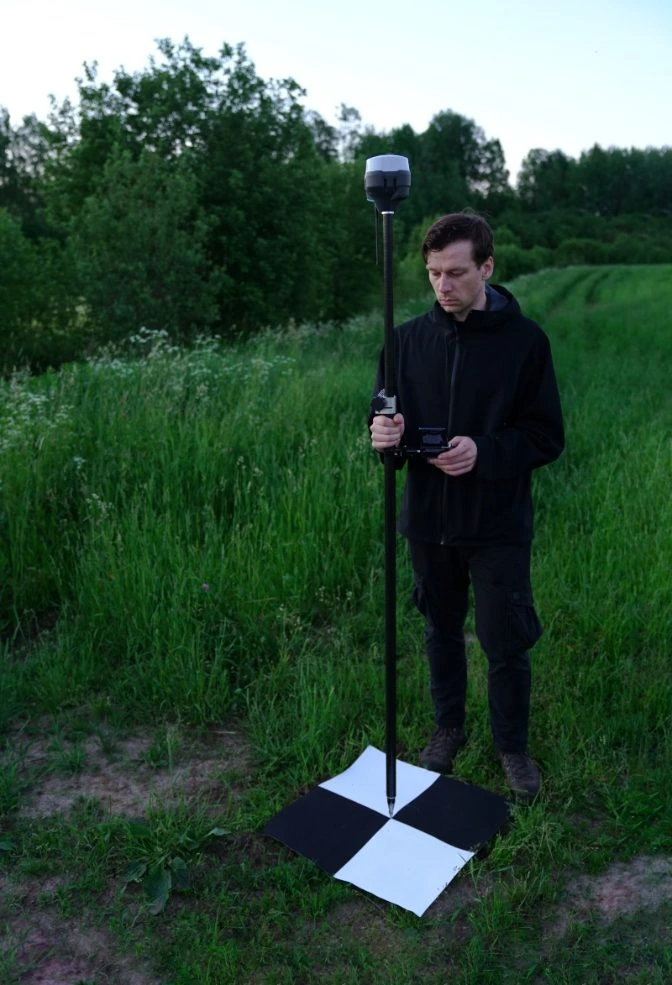 Calibrating GCPs
Getting the Right Data for Your Drone 3D Model
To create a detailed 3D model, you need to capture images from multiple angles. The more photos you take, the more accurate your model will be. Aerial photogrammetry relies on capturing the same object from different locations to triangulate its position in 3D space.
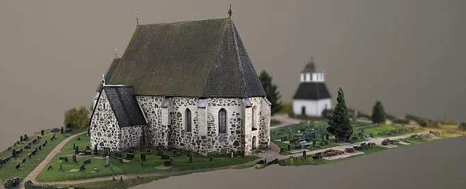 Drone 3D model | Source: Lassi Kaukonen
Key tips for setting up your flight:
- Ensure at least 60–70% overlap between consecutive images for better triangulation.
- Keep your drone between 150ft and 200ft for straight-down shots.
- Adjust the camera angle depending on the altitude: 30° for high altitude, 45° for medium, and 70° for low altitude.
- Keep the subject in frame by adjusting your flight radius accordingly.
Industries That Use Drone 3D Models
Drone 3D models are used across a wide range of industries due to their accuracy and ease of creation. Some of the most common applications include:
- Agriculture: Farmers use orthomosaic maps to monitor crop health and optimize resource use.
- Architecture & Engineering: Professionals use 3D models to visualize projects and secure funding.
- Construction: Companies track project progress and conduct inspections efficiently.
- Inspection Services: Inspectors identify issues in hard-to-reach areas safely and accurately.
- Land Surveying: Surveyors create historical records of land changes over time.
- Power Generation: Energy companies inspect infrastructure from a safe distance.
- Public Safety: Emergency responders use 3D models to assess disaster zones and crime scenes.
- Real Estate: Agents use 3D models and orthomosaics to showcase properties online.
The Future of Drone 3D Models
As technology continues to evolve, drones are becoming more advanced. New models like the Elios 3 are designed for indoor inspection and feature modular payloads, such as LiDAR sensors, that can generate real-time 3D maps. These innovations make it easier to collect and analyze data, improving efficiency and safety in various industries.
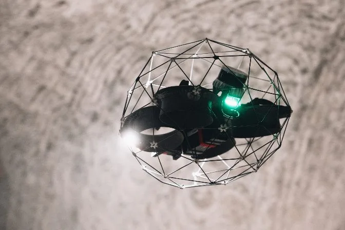
The Elios 3, for example, allows inspectors to navigate tight spaces and detect defects without putting themselves at risk. Its real-time 3D mapping capabilities provide a valuable tool for long-term asset management and maintenance tracking.
Gas Cylinder Accessories,Gas Cylinder Cap,Lpg Gas Cylinder Dust Plug,Protective Steel Handle For Cylinder
Hangzhou Qizheng Trading Co., Ltd. , https://www.gascylindercap.com